Progress is sometimes a step forward and backward at the same time, and in the name of progress the Office of Coast Survey terminated the Automated Wreck and Obstruction Information System application and deleted the AWOIS Excel and AWOIS KMZ (Google Map) files without prior notice in 2024. The AWOIS map viewer conveniently displayed lots of helpful information without having to click through multiple menu items and pages, and AWOIS site-specific numbers and compiled historical data were a standard reference in past National Ocean Service (NOS) hydrographic survey reports. That made them important to wreck research and thus to we wreck fishing anglers. So, why did NOAA cancel the application?
According to personal communication with NOAA, “the database was retired because it had not been updated for approximately 15 years, and with the advent of multibeam technology, it negated the need to establish search radius parameters for survey fleet. The wrecks which were found in the AWOIS database may have been re-surveyed or disproved since we stopped updating the AWOIS database. In such cases, more up-to-date information on wrecks and obstructions would now be reflected on the Electronic Navigational Charts (ENCs).”
While sympathetic to modern cartographic needs, after trying to use the ENC applications (ENC Direct to GIS, exported into shapefile or autocad formats), this user is left wanting something more straightforward and simpler. The majority of recreational fishermen would most likely prefer an easy-to-use app that displays useful data without a lot of fuss and technical know-how or commercial equipment and software. But with AWOIS gone, we’re left to fend for ourselves. And that’s exactly what I did.
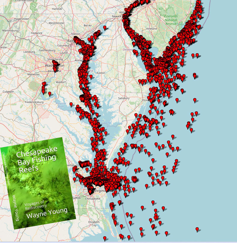
Having previously downloaded most of the AWOIS data for our region, I’ve been working to scale down area coverage for compatibility with a user-friendly mapping program. And now a simple interactive AWOIS map for Chesapeake Bay and DelMarVa waters is ready. FishTalk readers can access the map by going to the Chesapeake Bay Fishing Reefs Facebook page and following these steps:
- Click on the featured/lead post at the top.
- Scroll down and click on the AWOIS link.
- Save and open the download.
- When the map opens, click on the individual icons to see the AWOIS details on the wreck or obstruction.
For those not on Facebook, coordination is in progress to share the link through a website to be named. Now here’s a bonus: the mapping program allows changing the basemap. Go to the upper right corner to the menu box and select the basemap you want to use. For example, you can put a nautical chart or satellite image under the icons. Thanks for supporting FishTalk. Enjoy!
-By Wayne Young, the author of “Bridges Under Troubled Waters: Upper Chesapeake and Tidal Potomac Fishing Reefs,” “Chesapeake Bay Fishing Reefs, Voyage of Discovery,” “Phantoms of the Lower Bay,” and “Hook, Line, and Slinker.” All are available at Amazon.com.