Point Lookout is the southernmost part of Maryland, with the north-western shore of Virginia on the horizon about five miles to the south. In this border zone there are countless hotspots for fishermen of all types, both in the river itself and in the main-stem Bay. Before we look in detail at a few of these spots, however, a note of caution is in order: the mouth of the Potomac is broad, and the Bay offers the wind a fetch of over 15 miles here – over 20 miles if you discount the minor-league windbreak that is Tangier Island – making for some of the roughest waters in all the Chesapeake. This is not the place to test an unproven boat, nor push the limits of any sort of craft. That said, in good weather this territory offers some of the best fishing in the Chesapeake.
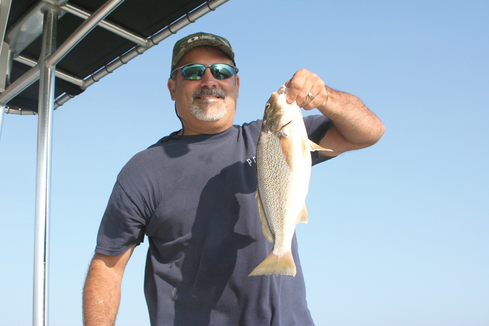
Chart 1
This chart details the water in the immediate area of Point Lookout, which is fished fairly heavily thanks to the easy access (there’s a great launch ramp facility with plenty of parking at Point Lookout State Park), and at times, shelter from the wind. The red arrows point to a pair of edges which jiggers and trollers will find are good areas to look for stripers from the early summer through the late fall. The spot on the east side of the point is also a good chumming spot many seasons, for both stripers and often for bluefish. It should also be tucked away in your brain as the place to try when the wind is piping down the river out of the west or north-west, although you should remember that rounding the point itself in rough conditions can be quite sporty.
Anglers will also find schools of stripers at the edge marked by the blue arrows, to the west of Point Lookout. But it’s most important to take note of this spot for flounder. True, we haven’t had strong runs of good-sized flounder up the Bay for many years. But the past two seasons the area has been paved in eight to 10-inch flounder and historically, this was always a good edge to try bouncing jigs on bottom or dragging Fluke Killers baited with bull minnow. It’s a safe bet that sooner or later, keeper sized flatfish will again be caught on this edge.
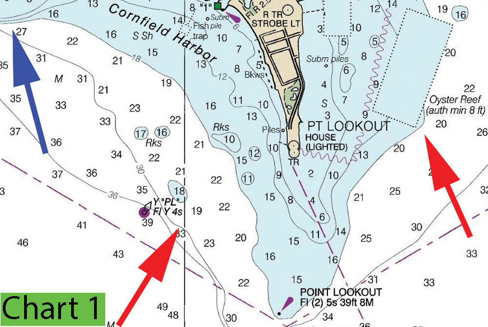
Chart 2
Taking a wider view of the area surrounding Point Lookout, the red arrows up the river point to the edges off St. George’s Island. This contour, running all the way up to Tall Timbers and beyond (going off this chart’s boundaries) is a good edge for striper anglers and has been particularly productive the past couple of seasons. Anchoring on the edge in 18 to 30 feet of water and chumming is highly effective here, as is trolling in a zig-zag pattern along the contour in the same depth range. In years past when yellowfin sea trout (weakfish) were more plentiful in the Bay they could often be found on the deep side of the drop in 40-plus feet of water, as well as in the deep mid-river holes.
To the far right on this chart, you’ll see a round red dot. This identifies a charted wreck. It’s not easy to find and your chartplotter will get you into the neighborhood, but that’s about it. That said, if you can locate it – a side-finder will make this task a lot easier – you’ll discover that particularly in the fall, it’s riddled with fish. Stripers hold right over it and can be targeted with either jigs or live spot, sometimes flounder will sit along its edges, and
The rectangular fish haven charted just to the north of this wreck shows good structure on the meter, but quite often the edges of the underwater point just to its north (off the upper edge of the chart shown here, Point No Point) in the 10- to 15-foot range holds more action for anglers dropping bloodworms on bottom rigs. Croaker, spot, puffers, small flounder, and similar bottom fish like this piece of bottom for some reason, and it’s a great place to try a few drifts for fast panfish action.
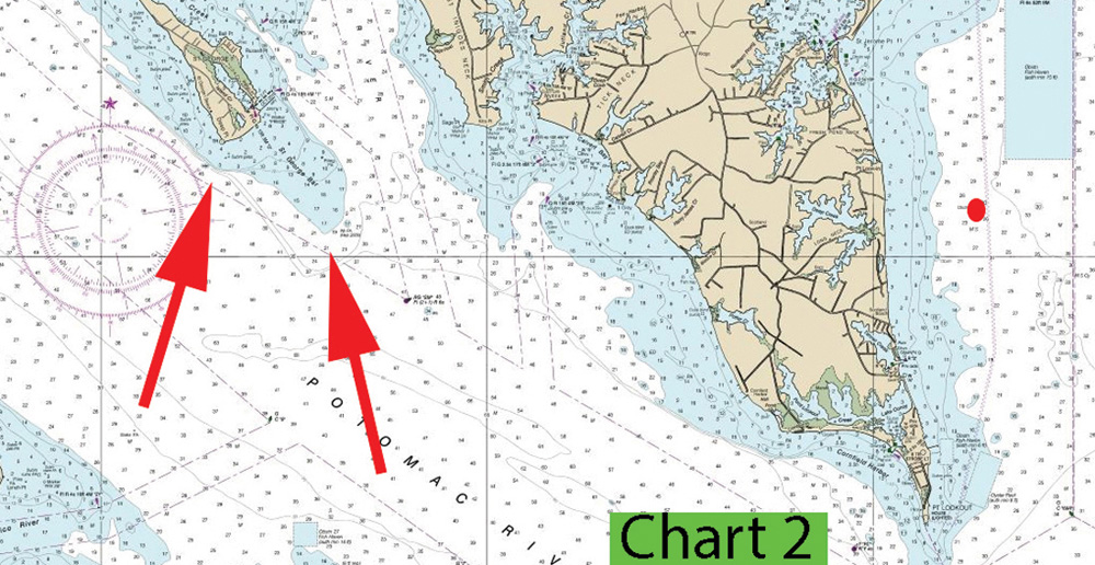
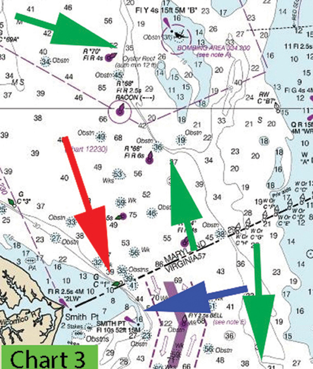
Chart 3
Moving south, note that the entire Virginia shoreline of the mouth of the Potomac from the Yeocomico all the way down to Smith Point can be a productive area to troll and/or search for working birds over stripers, which may be mixed with blues for much of the season. At the very mouth of the river off Smith Point, the sharp drop-off marked with the red arrow is a great edge for jiggers and chummers to work for stripers and bluefish, particularly on an outgoing tide. The blue area denotes the shallows on the north side of Smith Point Light, where ragged bottom and rapidly changing depth make for good fishing of all types; at times stripers can be jigged up here, on the shallower side bottom fishing with bloodworms on bottom rigs can be excellent, and if the keeper flounder return this steep drop-off is another great place to hunt for them.
The two upper green arrows on this chart denote the contour running from buoy 70 down to buoy 66. This entire edge can be productive for cobia when they range this far north in the Bay, and last year, produced good numbers of these fish for chummers using ground bunker for chum with bunker chunks and live eels set on bottom for bait. Remember that this tactic is most effective on the shallower parts of the edge, and 20 to 25 feet was the right zone to be in last season.
The lowest green arrow in this chart points south, to another chumming hotspot for cobia. It’s off the chart, but when you look on your chartplotter or paper chart, you’ll find a red number two nun buoy which sits just southwest of Tangier Island and the Tangier target ships. The beautiful drop-off from 15 to 35 feet here is another good bet when you have cobia set in your sights.
There’s a huge number of hotspots in the Point Lookout/Smith Point area which we haven’t covered here – in fact, it would take a book to touch on them all. But using these locations as starting points and exploring from there, you should be able to enjoy plenty of action the next time you head for the border.
Sign up here to get the weekly FishTalk Chesapeake Bay and Mid-Atlantic fishing reports in your email inbox, every Friday by noon.